The First Casualty of War
August 14, 2014 Leave a comment
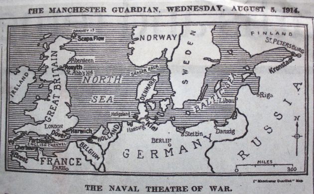
It seems like you can’t move without falling over a World War I anniversary at the moment, and in the Guardian last week there was a full page reproduction of a page from the Manchester Guardian of one hundred years earlier.
Fans of Alexander Gross’ Geographia Ltd will know all about his decision to sell high quality maps to the Telegraph in the run up to the war, but it looks like the Guardian had to throw something together at the last minute. This map of the North Sea is particularly ropey – it looks like I drew the coastlines of Norway and Denmark with my eyes closed. They say the first casualty of war is the truth, and this map seems to be telling more lies than most. If its only task is to show the rough position of May Island, however, it is performed adequately. There is at least a north arrow and a scale, and everything is spelled correctly. Maybe spending a bit more time on the Scottish border would have been good though. Compared to other cartographical cock-ups from media outlets, perhaps it is forgivable.
The main map at the head of the page looks a little less rushed, but is still kept fairly simple. Some of the borders are obviously different to today’s maps, but contemporary maps show they are not far off.

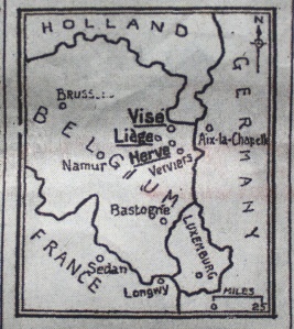
The other insert map, of eastern Belgium and surrounding countries, is also a bit scrappy. Some of the defects here could be due to the reproduction of a hundred-year-old newspaper though. I find it hard to get a sense of the region we’re looking at, without any coastline in view, but this map gives a good idea of how the Kingdom of Belgium looked at the time.


